What if a simple map of taps, fountains, and shade could save lives when temperatures spike in my city?
I share a practical, city-first playbook on urban heat islands and water access built from data and field-tested examples. My aim is to help cities protect people now while planning long-term resilience.
Heat waves are more frequent and longer across the United States. In some places the local effect rivals climate change projections, so planning must change.
This guide will explain why some neighborhoods face worse temperatures, who is most at risk, and how safe drinking points and cooling spots reduce medical visits. I cover short-term tactics like hydration hubs and cooling centers, plus longer-term fixes such as reflective roofs and more canopy.
I prioritize equity and practical outcomes: reliable taps, cooler shaded spaces at peak time, and clear wayfinding so people find help fast.
Key Takeaways
- A city-first playbook can cut heat-related harm now.
- Local effects can match long-term climate change in intensity.
- Safe drinking points and shade lower risk during spikes.
- Short-term and long-term tactics both matter.
- Prioritize vulnerable neighborhoods for the biggest impact.
Understanding the heat island effect and why water access matters now
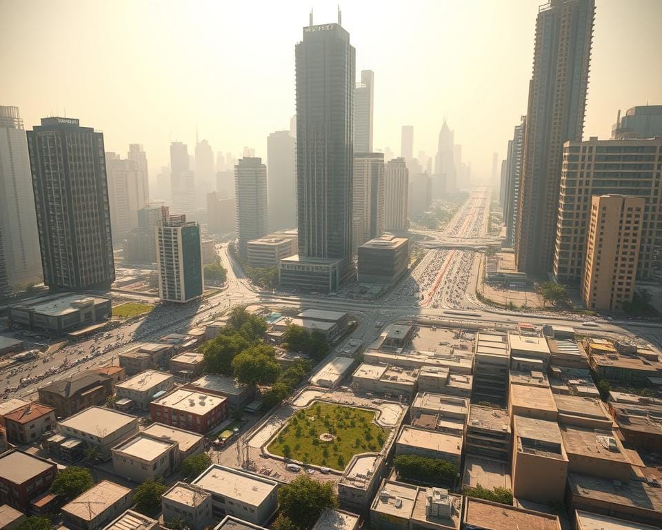
When concrete, rooftops, and thin tree cover hold daytime warmth, people face faster, longer exposure to dangerous temperatures. I want to explain how that happens, why most Americans are affected, and why ready drinking points and cooling spots matter today.
How built surfaces, density, and lost canopy trap warmth
Dark pavements and roofs absorb solar energy. Dense building canyons limit airflow. Reduced vegetation removes shade and evapotranspiration that would otherwise cool the air.
The U.S. context: population exposure and rising events
Less than 5 percent of U.S. land is built up, yet more than 80 percent of people live in those areas. That concentrates exposure to high temperatures where most residents live.
The average American saw three heat waves per year in the 1980s and five per year in the 2010s. Cities like Miami and New Orleans see eight or more additional events in some years.
When local warming rivals broader climate projections
In states such as Washington, Utah, Maryland, Mississippi, and Georgia, the added degrees from local warming can match or exceed late-century climate change estimates. That means city-scale adaptation is urgent, not optional.
- Microclimates vary block by block based on materials and canopy.
- Evaporation cools air; available drinking points and misting reduce peak exposure fast.
- Pairing water features with trees tackles both radiant and ambient temperature stress.
Health impacts I consider first during extreme heat
Small rises in daytime temperature often trigger sharp increases in illness; I start with what those rises mean for people’s health. Temperature-related harms follow a U-shaped mortality curve, so modest spikes above local norms can cause big jumps in serious outcomes.
The U-shaped mortality curve and why small spikes matter
The curve shows risk falls at moderate temperatures and rises steeply at extremes. Studies find that once daily temperatures pass about 30°C (86°F), each additional degree produces larger marginal impacts.
Who is most at risk
I watch children, older adults, pregnant people, and anyone with chronic conditions first. That includes asthma, COPD, cardiovascular disease, diabetes, long COVID with dysautonomia, Lupus, and MS.
Medications change risk. Beta blockers blunt heart response. Antipsychotics and stimulants can impair thermoregulation. Chemotherapy raises dehydration risk.
Dehydration and electrolytes: the frontline link
Emergency departments see surges when temperatures hit the upper 80s to low 90s°F; dehydration is a leading cause. Sweat removes sodium and other electrolytes, so plain fluids may not suffice for some people.
- Replace fluids and salts—oral rehydration or balanced drinks can prevent collapse.
- Early-season spikes are risky because people are not acclimatized.
- Reducing exposure time with shade, nearby drinking points, and cool places saves lives.
urban heat islands and water access
I make the case that reliable taps, shade, and active spray systems are core public infrastructure in hot areas of a city. When built materials trap warmth, these elements stop minor dehydration and overheating before they become emergencies.

Access to safe drinking, shade, and cooling as life-saving infrastructure
I define access as safe, 24/7 drinking points plus well-marked shaded places to rest. These features save lives in neighborhoods with the strongest island effect.
- Combine fountains with misting nozzles so people hydrate and cool in one stop.
- Prioritize installations in areas with higher temperatures and fewer amenities to advance equity.
- Ensure units run after hours and follow strict cleaning and maintenance schedules.
Air temperature versus body temperature: misting, evaporation, and relief
Spray cooling lowers air temperature by evaporation, heat absorption, and heat transport. Flowing streams cool more than still pools because mixing moves heat away faster.
Fine mists boost evaporation on skin and drop body temperature quickly. Paired with trees or shade structures, sprays reduce perceived temperature more than shade alone.
Clear wayfinding, routine sanitization, and simple public guidance—drink often, use misting safely, and rest in shade—make these investments effective during surges.
Best practices: public water features that cool cities without wasting water
I focus on practical steps cities can take now to keep people safe while using resources responsibly. Good designs deliver hydration, evaporative cooling, and clear routes to relief without excessive loss.
Drinking fountains: placement, reliability, and 24/7 standards
I recommend fountains every few blocks in busy corridors, at transit stops, parks, and near large housing. Prioritize hotter blocks and lower-income neighborhoods for the biggest benefit.
Units should meet uptime standards during events: 24/7 operation, rapid repair SLAs, automated failure alerts, and backup units in high-use spaces. Regular sampling and visible maintenance logs build public trust.
Cooling by spray: misters, splash pads, and spray parks
Fine nozzles, timed cycles, and shaded seating help splash pads cool people without wasting liters. Hybrid units that combine bottle fillers, bubblers, and low-flow misters give hydration and evaporative relief from one footprint.
Flowing water vs. standing water: maximize evaporation and heat transport
Flowing channels, rills, and moving streams cool better than static basins. Spray has the greatest effect because fine droplets raise surface area and speed evaporation, especially when directed into prevailing wind.
Wayfinding and digital maps so residents find relief fast
- Publish fountain locations in a public digital map with an open data feed.
- Add physical signage, coordinate with transit apps, and push heat alerts with nearest points via SMS.
- Design ADA-compliant controls, multilingual labels, and tactile or audible cues at large sites.
I draw on examples like Budapest’s cooling program and Paris’s hybrid misting-drinking fountains to show how cities can scale these systems while conserving resources and keeping people safe.
Designing for efficiency: sustainable water use in a warming climate
I prioritize designs that stretch every drop while keeping cool spots reliable when people need them most. Efficient choices cut operating costs and reduce strain on public supplies during peak demand.
Demand-control and recirculation
I specify sensor-activated fountains, timed spray cycles, and pressure regulators so features do not run continuously. Closed-loop systems recirculate in rills and mist zones with filtration and UV treatment.
Non-potable sourcing and WSUD
Use harvested rain through well-designed rainwater harvesting systems or treated wastewater for plaza wetting and evaporative cooling. Water Sensitive Urban Design ties green spaces and planting trees to cooling corridors that cut air temperatures where people walk.
Operations, maintenance, and safeguards
- Define drought stages with automatic runtime limits and non-potable-only modes while keeping drinking points uninterrupted.
- Prioritize durable parts, frequent filter changes in dusty zones, and monitoring with flow meters and temperature sensors.
- Manage aerosol drift and runoff to protect the environment and nearby vegetation.
Short-term heat management versus long-term mitigation
Cities need both rapid protections today and structural fixes that cool neighborhoods over years. I separate what must happen right now from what we plan to change later.

Management now: cooling centers, air conditioning, and hydration plans
I open cooling centers, extend hours, and expand access air conditioning during forecasted spikes. I pre-position bottled water, coordinate rides for people without cars, and deploy mobile units to areas with low AC penetration.
I put hospitals on alert, sync EMS with clinics, and run community checks for homebound neighbors. I push multilingual alerts and 311 integrations so people spend less time exposed while they find relief.
Mitigation later: reflective roofs, trees, transit, and less pavement
Over years I invest in reflective cool roofs, shaded bus stops, more trees along walking routes, and fewer paved surfaces. These measures lower baseline temperatures and reduce peak events across the city.
I link transit expansion and new bike lanes to cooler streets. Plazas get shade, permeable paving, and low-flow spray features that pair comfort with efficient water use.
- Proactive ops before spikes: extend hours, stage supplies, arrange transport.
- Equity focus: mobile cooling for low-AC neighborhoods and homebound outreach.
- Measure progress year over year: indoor relief, AC penetration, shade distribution.
| Timeframe | Key Actions | Metric | Priority Areas |
|---|---|---|---|
| Now (days–months) | Open centers, expand air conditioning access, pre-stage supplies | Center hours, generator uptime, AC usage rates | Low-AC neighborhoods, high-morbidity zones |
| Near term (years) | Install cool roofs, plant trees, shade transit stops | Canopy cover %, surface temps, transit shade km | Downtown corridors, dense residential areas |
| Ongoing | Monitor, update plans, run drills, maintain systems | Response time, outreach counts, temperature reductions | Many cities with varied climates |
Equity, environment, and justice: fixing uneven heat exposure
Decades of planning choices left some neighborhoods far hotter and less resourced than others.
Redlining and segregation meant fewer trees, denser housing, and more pavement in many areas. That history raises exposure for people who live in those blocks and increases health risk during high temperatures.
Redlining legacies: fewer trees, more concrete, higher temperatures
Studies in Cleveland and other cities show racial minorities face greater vulnerability. Socioeconomic conditions and limited vegetation explain much of the gap.
Gaps in communication: cooling center hours and access barriers
Many cities leave center hours unclear. People miss relief when schedules are inconsistent or not in multiple languages. I push for extended evening and weekend times, clear signage, transport options, and ADA-compliant routes so more people find safe spaces quickly.
Targeting investments to vulnerable neighborhoods first
- I prioritize shaded spaces, refill stations, and misting features in the hottest, lowest-income areas.
- I work with trusted messengers—community groups, clinics, and faith leaders—to share alerts and guidance.
- I fund utility subsidies and prevent shutoffs during events, then track costs versus avoided ER visits to show impact.
| Priority | Action | Metric |
|---|---|---|
| Short term | Shade canopies, mobile relief | Travel time to spaces |
| Near term | Street trees, reflective roofs | Surface temp drop |
| Ongoing | Community dashboards, feedback loops | ER visits avoided |
City playbook: operations, partnerships, and public messaging
I set clear operational rules so a city can move fast when temperatures threaten public health. My plan ties health, utilities, parks, housing, and emergency teams into a single incident system with clear roles and triggers.
Coordinating health, water, parks, and emergency management
I stand up a command center that links public health, water utilities, parks crews, housing, and emergency management. We use forecast thresholds to flip switches: open centers, run misters, and dispatch repair crews.
Standards for hours of operation during extreme events
I set minimum hours for cooling centers during declared alerts, including nights and weekends. Fountains, misters, and verified air conditioning units run whenever alerts are active. Rapid-response teams fix outages fast to keep service reliable.
Community outreach: trusted messengers and multilingual alerts
I work with libraries, clinics, schools, and NGOs to reach people without phones. I push SMS, radio, and door-to-door notices in multiple languages. Block ambassadors check on elderly neighbors and deliver fluids or electrolyte packets when needed.
- Publish real-time maps of centers and refill points tied to alerts.
- Provide temporary access air kits and verify air conditioning in neighborhood rooms.
- Waive ID, allow pets when safe, and keep clear SOPs for after-action review.
| Function | Trigger | Metric |
|---|---|---|
| Command center | Forecast threshold met | Activation time, partner count |
| Cooling centers & AC rooms | Alert active | Hours open, occupant capacity |
| Community outreach | Alert + hotspot map | Contacts reached, deliveries made |
For detailed implementation guidance, I reference the local playbook implementation plan to shape SOPs that fit cities across the United States.
Signals from the field: lessons from U.S. cities and abroad
I reviewed programs from the Great Lakes to Budapest and Paris to see what scales quickly and what still fails in practice.
Great Lakes cities: rising waves and management gaps
Cities like Chicago, Cleveland, Detroit, Milwaukee, Windsor, and Toronto register peak spots 15–20°F hotter than nearby greener areas. In Chicago alone roughly 938,000 residents live inside an urban heat island, which calls for sharper neighborhood targeting.
Many northern towns do well on long-term mitigation but lag at rapid response. Ambiguous center hours and patchy communications leave people exposed when they need help most.
Budapest and Paris: mapped relief and hybrid fountains
Budapest’s Cooling Programme pairs mapped cooling islands with dense fountain networks so residents find relief fast. Paris uses hybrid misting-drinking fountains that combine hydration and evaporative cooling in busy squares.
- Design matters: fine spray and flowing features cut local air temperature while shaded benches increase safe dwell time.
- Operational fixes: map every source, extend hours during alerts, and deploy mobile units to underserved blocks.
- Equity first: prioritize hottest, least-treed neighborhoods for immediate deployment.
| Lesson | Action | Metric |
|---|---|---|
| Mapping | Publish real-time fountain & cooler locations | Find time to nearest point (mins) |
| Operations | Extend hours during alerts, mobile units | Hours met vs. target |
| Performance | Log use, local air temp change | Users per hour; °F drop |
Conclusion
I close by urging cities to treat reliable refill points and smart cooling as public health tools. In places where the urban island effect stacks on rising temperatures, these measures cut risk fast.
Evaporative cooling from misters and flowing features lowers perceived temperature and cools skin quickly. Pair that with shade to extend safe time outdoors and keep air moving for better relief.
I prioritize equity: map hotspots, work with community partners, and serve the hottest areas first. I back sensor-driven, closed-loop designs to conserve water while keeping services reliable.
Short-term management saves lives now. Long-term fixes — reflective roofs, tree planting, redesigned streets — reduce peak temperatures later. Publish hours, measure uptime and local impacts, share what works across many cities, and track health outcomes so results stay central.
Act now: fund priority corridors, build partnerships, and deliver cooling where people live, commute, and gather. Learn more about the health benefits of drinking water as part of a life‑saving strategy.