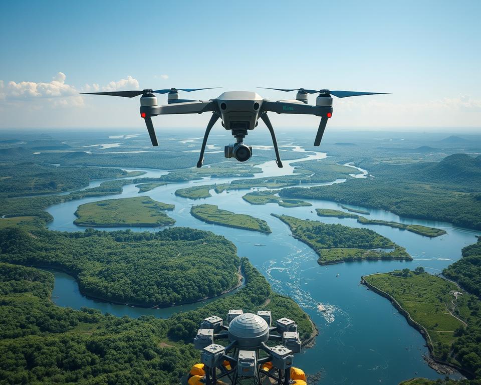
Drone mapping of water resources has sparked a revolution in environmental monitoring. These flying technological marvels capture intricate details of watersheds, rivers, and reservoirs with incredible precision. My first encounter with aerial water resource surveying left me stunned by its potential.
I watched a compact drone reveal complex water flow patterns in minutes. Traditional mapping methods would have taken weeks to complete the same task.
Water management professionals are discovering these autonomous flying devices aren’t just cameras in the sky. They’re sophisticated data collection platforms capable of transforming how we track, analyze, and protect water ecosystems. By providing real-time, high-resolution imagery across challenging terrains, drones have become indispensable tools.
Environmental scientists and resource managers now rely on drones for comprehensive insights into water systems.
Key Takeaways
- Drones revolutionize water resource monitoring with unprecedented speed and accuracy
- Aerial surveying provides comprehensive data previously impossible to collect
- Technology enables rapid assessment of hard-to-reach water systems
- Cost-effective alternative to traditional ground and satellite monitoring methods
- Real-time data collection supports more dynamic environmental management
Why Traditional Water Resource Monitoring Methods Fall Short
Water resource management has long struggled with inefficient and risky monitoring techniques. Traditional methods of tracking watersheds reveal significant limitations that prevent accurate data collection. UAV water body monitoring emerges as a critical solution to these persistent challenges.
Time-Consuming Manual Inspections and Ground Surveys
Ground-based water resource surveys represent an outdated approach fraught with obstacles. Research shows field teams can spend weeks surveying a single watershed. They battle challenging terrain and unpredictable weather conditions.
These manual inspections typically yield incomplete data sets. They consume substantial financial and human resources.
- Terrain accessibility restrictions
- Limited data collection points
- Extended survey timelines
- High personnel deployment costs
Limited Scope of Satellite Imaging
Satellite remote sensing for watersheds offers broad coverage but lacks critical precision. Most satellite images struggle to provide resolution below 10-20 meters. This makes detailed local analysis impossible.
Cloud cover and infrequent imaging further reduce their practical utility for water resource management.
High Costs and Safety Risks in Hazardous Areas
Professional water monitoring involves significant human and financial risks. Accessing flood zones, steep riverbanks, or contaminated regions can endanger personnel. It requires extensive insurance and equipment investments.
UAV water body monitoring provides a safer, more cost-effective alternative. It minimizes direct human exposure to dangerous environments.
- Reduced personnel risk
- Lower operational expenses
- Real-time data collection
- High-resolution environmental mapping
The Core Technology Behind Drone Mapping of Water Resources
Modern hydrological drone surveys have revolutionized water resource monitoring with cutting-edge technological capabilities. Advanced drones now carry sophisticated sensors that transform how we understand water systems. These tools provide unprecedented insights into aquatic environments.

The core of lidar water mapping technology relies on three primary sensor types. These sensors dramatically enhance data collection.
- Multispectral cameras capturing data beyond visible light spectrum
- LiDAR systems generating precise 3D terrain elevation models
- Hyperspectral sensors detecting water contaminants and environmental changes
These advanced sensors enable drones to perform complex water resource assessments with remarkable precision. Specialized drones can now operate in challenging weather conditions. They feature IP55 and IP56 weather resistance ratings that allow continuous monitoring during rain and wind.
| Drone Type | Coverage Area | Primary Application |
|---|---|---|
| Fixed-wing Drones | Large watersheds | Extended mapping missions |
| Hybrid VTOL Systems | Complex terrain | Vertical and horizontal flight capabilities |
| Quadcopter Drones | Small water bodies | Detailed local inspections |
Hydrological drone surveys now leverage GPS and RTK positioning technologies. This ensures centimeter-level accuracy in water resource mapping. Researchers and environmental managers can collect comprehensive data quickly and safely, transforming our understanding of aquatic ecosystems.
Real-Time Water Level Monitoring and Flow Pattern Analysis
Drone technology has changed precision water resource management completely. It provides new insights into water systems. Multispectral imaging for hydrology helps water managers track environmental changes accurately and quickly.
Advanced aerial monitoring changes how we understand water dynamics. Drones capture details that traditional methods miss. They create a complete view of river and drainage system behaviors.
Detecting Anomalies in Rivers and Drainage Systems
Advanced drone technologies identify critical water resource challenges through sophisticated imaging techniques:
- Tracking sediment accumulation in river channels
- Identifying unauthorized water diversions
- Detecting infrastructure blockages
- Monitoring erosion patterns
Automated Alerts for Overflow Risks
Real-time data processing enables immediate risk assessment and prevention strategies. Drone-collected information triggers instant notifications. This happens when water levels approach critical thresholds.
| Monitoring Parameter | Detection Capability | Response Time |
|---|---|---|
| Water Level Changes | Continuous Tracking | Immediate |
| Flow Rate Variations | Precise Measurement | Within Minutes |
| Potential Overflow Risks | Predictive Analysis | Early Warning |
These advanced monitoring techniques represent a major leap in water resource management. They transform reactive approaches into proactive prevention strategies.
High-Resolution Aerial Mapping for Watershed Assessment

Geospatial analysis of aquatic systems has changed dramatically with drone technology. These advanced aerial tools capture incredibly detailed images of watersheds. They unlock unprecedented insights into water resource management.
Drone mapping brings extraordinary capabilities to watershed assessment. High-resolution cameras and specialized sensors capture images with remarkable 2-5 centimeter ground resolution. This level of detail allows researchers to:
- Identify minute erosion patterns along stream banks
- Map riparian vegetation health with extreme accuracy
- Document seasonal changes in river channels
- Create detailed topographic models predicting water flow
The cost-effectiveness of drone-based geospatial analysis of aquatic systems is stunning. What previously required expensive manned aircraft now takes just days to complete. Water resource managers gain real-time data enabling proactive environmental management strategies.
| Traditional Mapping | Drone Mapping |
|---|---|
| Cost: $50,000-$100,000 | Cost: $5,000-$15,000 |
| Time: 6-8 weeks | Time: 1-2 weeks |
| Resolution: 30-50 cm | Resolution: 2-5 cm |
Environmental scientists can now model complex watershed scenarios with unprecedented accuracy. The future of water resource management has arrived. It is precise, efficient, and technologically driven.
Integrating AI and Predictive Modeling for Water Management
Environmental drone mapping is changing how we understand and manage water resources. Water management professionals can now predict and prevent potential challenges with great accuracy. This happens by combining cutting-edge technology with advanced artificial intelligence.
Environmental drone mapping turns raw data into actionable intelligence. Drones capture high-resolution imagery that AI systems analyze. This creates comprehensive insights about water systems that were impossible just a decade ago.
Historical Data Integration with Real-Time Drone Surveys
Water management experts now use drone technology to build predictive models. They combine historical records with current data.
- Tracking river channel migration patterns
- Measuring erosion rates over time
- Analyzing vegetation health during climate changes
- Predicting water storage capacities
One water district integrated 15 years of ground survey data with monthly drone mapping. This created a predictive model that optimizes maintenance schedules and saves significant resources. Urban water management strategies are increasingly relying on such innovative approaches.
Smart Hydrological Monitoring and Early Warning Systems
AI-powered environmental drone mapping now enables automatic detection of critical water system changes:
- Water color variations indicating potential pollution
- Flow velocity measurements
- Infrastructure stress point identification
- Flood prediction through advanced terrain modeling
These intelligent systems provide real-time alerts. They help water management professionals make proactive decisions. These decisions protect communities and infrastructure.
Environmental Impact Analysis and Ecosystem Protection
Drone technology has revolutionized environmental monitoring. It provides unprecedented insights into ecosystem health and water resource management. These advanced aerial systems offer a non-invasive approach to studying delicate environmental landscapes.
Water resource monitoring through drones enables researchers to track critical ecosystem indicators. This happens with minimal environmental disruption. Multispectral imaging allows for detailed analysis of:
- Wetland vegetation changes
- Riparian habitat conditions
- Stream ecosystem recovery
- Pollution source identification
Drones capture high-resolution data that helps scientists understand complex environmental interactions. Watershed assessment technologies now leverage drone capabilities effectively. They monitor ecosystem health better than traditional ground-based methods.
| Drone Monitoring Capability | Environmental Impact |
|---|---|
| Multispectral Imaging | Detect early invasive plant spread |
| Thermal Mapping | Identify critical wildlife habitats |
| Vegetation Stress Analysis | Track water quality changes |
The minimal environmental footprint of drone technology sets it apart. Researchers can now gather critical ecological data without disturbing sensitive habitats. Drone-based environmental monitoring offers a sustainable solution for ecosystem protection.
Conclusion
Water management faces critical challenges in the 21st century. Advanced drone technologies are changing how we monitor and protect water resources. By 2050, rising flood levels could impact over 70 million people in coastal cities.
AI-powered drone mapping offers a breakthrough in water resource management. These aerial systems deliver precise, high-resolution data in hard-to-reach areas. They rapidly survey watersheds, detect problems, and generate real-time insights for environmental protection.
The future of water monitoring requires an integrated approach. Drones work alongside ground sensors, satellite imaging, and predictive modeling. This combination creates comprehensive environmental intelligence for better decision-making.
As sensor technologies advance and regulations evolve, drone monitoring becomes increasingly important. These tools help us address climate change challenges. They also protect vital water ecosystems for communities worldwide.
Organizations using innovative drone technologies are building resilient water management systems. They improve data collection while creating adaptive solutions. By bridging prediction and prevention, we can ensure sustainable water resources for future generations.