
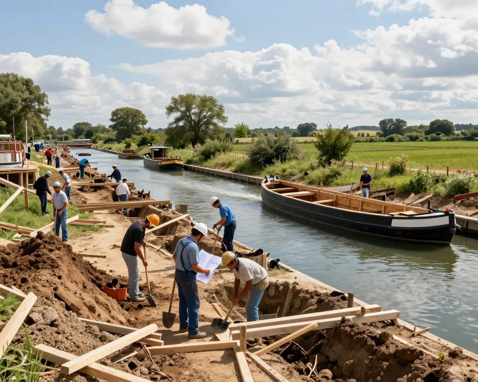
The history of canal building reshaped transportation and trade across regions. Early projects created a controlled water way that cut costs for moving bulk goods and linked distant markets.
Engineers moved from simple cuts to systems with locks, aqueducts, and precise grade control. That evolution made long-distance canals practical and reliable by the 19th century in the united states and abroad.
Public policy and funding decided which projects reached completion. Debates over internal improvements guided where investment went and how maintenance became part of governance.
This section sets the scene for key projects, methods, and lessons that inform modern infrastructure thinking. For practical maintenance parallels see a related guide on how to replace a water main.
Key Takeaways
- Canals transformed bulk transportation by lowering cost per ton-mile.
- Designs evolved from basic cuts to integrated water systems with locks.
- 19th century projects in the united states opened interior markets.
- Policy choices determined where and when development advanced.
- Lessons from past projects still apply to today’s infrastructure debates.
Why Canals Changed the World of Transportation and Trade
Water routes made heavy cargo cheaper and more reliable to move.
A single horse could tow a barge holding many tons. That beat a wagon team on a rough road. Boats float, so rolling resistance is low. Less breakage and fewer delays followed.
Canals kept depth and flow steady. That predictability let a system carry grain, timber, coal, and stone across a region. Shippers set schedules. Insurers lowered rates. Markets opened farther from farms and mills.
- Lower unit cost per ton
- Year-round shipping in wet seasons
- Fewer losses and better scheduling
| Metric | Roads (Wagon) | Canals (Barge) |
|---|---|---|
| Typical load per horse | 1–2 tons | 10–30 tons |
| Rolling resistance | High | Low |
| Reliability | Seasonal | Predictable |
| Network effect | Limited | Strong (ports, warehouses) |
These improvements shaped trade patterns and set expectations for later transport projects. Cities and manufacturers clustered along the way. That shift is a key chapter in the broader history of infrastructure.
From Irrigation Cuts to Global Waterways: Early Roots of Canal Construction
Early engineers turned marsh, lake, and river links into planned passages for steady navigation. These first projects mixed local needs with state aims. They show how simple fixes scaled into strategic arteries.
Darius I and the Nile–Red Sea link
Between about 520 and 510 BC, Darius I commissioned a canal near modern Ismailia to join the Nile with the Red Sea. The work shortened the distance for river traffic to reach sea trade. It served military, tax, and trade functions and proved state capital could fund large water projects.
China’s Grand Canal and grain movement
The Grand Canal linked the Yangtze and Yellow rivers and later reached Beijing under Mongol rule. For centuries the route moved grain north to supply the capital. Standard widths and towpaths supported steady traffic for many miles.
Lessons in routes, water, and terrain
Early builders learned that careful alignment cuts costs. Balancing cut-and-fill, using natural depressions, and integrating lakes conserved flow and reduced lift over long distances.
Flash locks let boats pass with a surge but were risky. The pound lock, developed in China by the 10th century, provided a gated chamber and repeatable level control. That advance turned intermittent passage into reliable navigation and set engineering norms still used today.
- Match route to terrain to limit earthwork.
- Standardize cross-sections for predictable traffic.
- Pair technical fixes with administration for maintenance and tolling.
Engineering Breakthroughs that Made Long-Distance Navigation Possible
A sequence of mechanical and material advances made sustained navigation over long distances reliable. Engineers learned to shape flow, save time, and lower labor for towing and locks. These changes turned scattered waterways into connected routes.
Flash locks to pound locks: controlling water levels and current
Flash locks used sudden surges to pass craft. They were fast but risky for boats and crews.
Pound locks created a chamber with gates at each end so a boat can rise or fall by equalizing water levels before a gate opens. That two-way control reduced delays and damage.
Mitred lock gates and the leap to efficient elevation change
Mitred gates close at an angle into the higher head so water pressure seals them tight. This cut leakage and lowered the force needed to move gates.
Switching from guillotine-style leaves to mitred pairs extended service life and made lock operation easier on crews and tow animals.
Aqueducts and materials: from masonry to cast iron at Pontcysyllte
Aqueducts carried a canal across deep valleys so routes stayed level and avoided long staircases of locks.

Thomas Telford’s Pontcysyllte used a cast-iron trough nearly 12 feet wide with a towpath. The material cut weight and let longer spans stand on fewer piers.
| Feature | Flash Lock | Pound / Mitred |
|---|---|---|
| Control | Surge | Measured levels |
| Risk to boats | High | Low |
| Operational effort | Variable | Standardized |
Europe’s Canal Age: Linking Rivers, Regions, and Markets
Across Europe, planned waterways turned regional markets into connected networks. Builders used measured grades and reservoirs to keep flow steady. Projects proved that a long route could serve trade with predictable schedules.
From Milan’s Naviglio Grande to the Stecknitz
Naviglio Grande (1179–1209) moved marble to Milan over 31 miles and dropped about 110 feet. That work showed a single city could finance a dependable supply line and cut costs.
The Stecknitz linked Lübeck to the Elbe in the early 15th century. It created a continuous waterway that cut transshipment and opened Baltic trade to inland markets.
Briare and the Canal du Midi
Briare, completed in 1642, used a six-lock staircase that dropped 65 feet at one point to speed throughput.
The Canal du Midi, roughly 150 miles long, handled a 206-foot descent in 32 miles, built three aqueducts and a 180-yard tunnel. Its scale proved tunnels and aqueducts solved hard terrain.
| Project | Length | Key feature |
|---|---|---|
| Naviglio Grande | 31 miles | 110 feet fall |
| Briare | Short link | 6-lock staircase (65 feet) |
| Canal du Midi | 150 miles | Tunnel, aqueducts, 206-foot descent |
- Standard chamber sizes and coordinated operation reduced idle time at locks.
- Canals spurred growth: mills, warehouses, and prime waterfront land in many a city.
- By the 19th century these precedents set expectations for integrated freight corridors.
The History of Canal Building in the United States
Canals in the united states began as pragmatic bypasses for rapids and falls. Early projects proved technical methods and funding models that later scaled into public works.
The Proprietors of the Locks and Canals on Connecticut River finished South Hadley in 1795, the first navigable U.S. canal. Turners Falls followed in 1798. Other early works included the Dismal Swamp, Santee, Bellows Falls, and the Middlesex.
New york authorized the Erie Canal in 1817. It opened in 1825 with 363 miles and 83 locks linking the Hudson to Lake Erie. The route created a reliable path west and cut freight time and cost.
- Between 1816 and 1840 the united states built 3,326 miles of canals.
- Syracuse, Buffalo, and Cleveland expanded as logistics and manufacturing hubs.
- Several state treasuries, notably in Pennsylvania, Ohio, and Indiana, felt fiscal strain from rapid construction and upkeep.
Federal policy shifted to active support after 1824. The General Survey Act and rivers-and-harbors laws began Army Corps surveys and navigation improvements. Legal rulings like Gibbons v. Ogden clarified interstate commerce and cleared the way for coordinated works.
Engineering, finance, and law combined to form a durable model for later infrastructure. For related modern water management practices see preventing saltwater intrusion in coastal aquifers.
| Topic | Data | Impact |
|---|---|---|
| Erie Canal | 363 miles, 83 locks (opened 1825) | Opened western trade to New York |
| Canal miles (1816–1840) | 3,326 miles | Regional network growth |
| Policy | 1824 Survey Act; 1826 expansion | Army Corps civil works began |
New York’s Erie Canal and a Nation on the Move
Practical design choices—width, depth, and modest lifts—made a lengthy route reliable. The erie canal ran 363 miles with 83 locks from the Hudson River to Lake Erie. That single corridor let cargo travel from Atlantic ports to inland markets without repeated transshipment.

Engineering details in plain terms
Engineers set standard lock sizes and a consistent channel profile. Those limits defined what boats could carry and the draft they needed. Feet-wide cross-sections balanced excavation cost and traffic capacity.
- Gentle grades cut tow effort and reduced bank erosion.
- Modest feet of lift per lock sped cycles and kept turbulence low.
- Depth, width, and bank protection let boats pass safely at constrictions.
Economic ripple effects
The corridor steered traffic west and made Buffalo a gateway. Syracuse and Cleveland grew as processing and distribution city hubs. Tolls, dredging, and seasonal management kept capacity aligned with demand.
| Feature | Value | Outcome |
|---|---|---|
| Length | 363 miles | Direct Hudson–Lake Erie link |
| Locks | 83 | Managed elevation, steady flow |
| Standard profile | Feet-wide channels | Predictable boat size and cargo |
| Economic hubs | Buffalo, Syracuse, Cleveland | Regional growth, westward traffic |
Canals in American Cities and Landscapes
Urban waterways blended utility and ceremony, shaping streets and public space in U.S. capitals.
Washington’s Mall alignment and civic design
Pierre-Charles L’Enfant set a central line that linked the Mall to the Capitol. Benjamin Henry Latrobe and Charles Bulfinch tightened alignments. Bridges, walks, and banks framed views and eased access. Robert Mills later helped integrate ornament with function.
Fairmount Water Works: utility and promenade
Philadelphia’s Fairmount Water Works used a canal 40 feet wide and 200 feet long. A tunnel cut through granite carried intake flows from the Schuylkill. The site doubled as a public promenade and an engineered works that improved health and supply.
- City plans treated waterways as infrastructure and amenity that anchored public spaces.
- Aligning channels with vistas merged circulation, scenery, and civic symbolism.
- Landscape treatments raised property values and encouraged maintenance.
- Seasonal operations balanced supply, storm control, and recreation.
| Project | Dimension | Primary role |
|---|---|---|
| Washington Canal | Aligned with Mall axis | Vistas and circulation |
| Fairmount Works | 40 ft × 200 ft; granite tunnel | Water supply and promenade |
| Urban canals | Variable | Stormwater, public health, recreation |
These cases show how targeted improvements in the united states matched engineering with urban design. For modern source protection and intake planning see preventing saltwater intrusion in coastal aquifers.
Global Megaprojects and Their Legacy
Two 19th-century megaprojects rewrote global shipping routes and strategic maps.
First, the Suez project began under Ferdinand de Lesseps in 1859. Workers removed roughly 97 million cubic yards. Port Said emerged as a new port town. The route used Lake Timsah and the Bitter Lakes to cut excavation along many miles. The canal opened in 1869 with a ceremony led by the French imperial yacht. It shortened distance and cut voyage time to Asia. Trade and naval routes shifted almost overnight.
Second, the Panama design chose locks and a high lake over a sea-level cut. After U.S. control of the zone in 1903, engineers John F. Stevens and George W. Goethals finished construction. Gatun Lake became the central reservoir. Locks on each side lifted ships and managed salinity and currents. The canal opened August 15, 1914 and altered oceanic logistics for both commerce and military fleets.
| Feature | Suez (opened 1869) | Panama (opened 1914) |
|---|---|---|
| Design choice | Sea-level cut using natural basins | Lock-lift with high lake (Gatun) |
| Excavation | ~97 million cubic yards removed | Reduced by lock approach; massive earthworks in Culebra |
| Operational aim | Shorter Mediterranean–Red Sea distance and time | Reliable transit between Atlantic and Pacific; control of hydrology |
| Geopolitical effect | Reordered trade lanes; new imperial staging ports | Accelerated naval mobility and hemispheric commerce |
- Suez leveraged lakes to limit digging and stabilize levels.
- Panama balanced rainfall, slope, and salt with locks and a lake.
- Both projects proved that coordinated engineering and governance can shrink distance and time across regions.
Conclusion
When route, storage, and rules align, a single project can reshape regions. That point underpins lasting success in canal building and modern waterway development.
Practical lessons are clear. Size locks and channels to a standard feet wide profile. Provide storage so navigation holds through dry years. Pair engineering with state oversight and steady funding for dredging and repairs.
One well-executed corridor — think Lake Erie and the Erie Canal — shifted traffic west and reset regional growth in the united states. Planners today should borrow those standards, staged lift, and clear operating rules to cut delay and extend service life. For practical water management ideas see rainwater harvesting in arid climates. The lasting success of these works rests on engineering clarity and policy continuity, not a single burst of construction.