
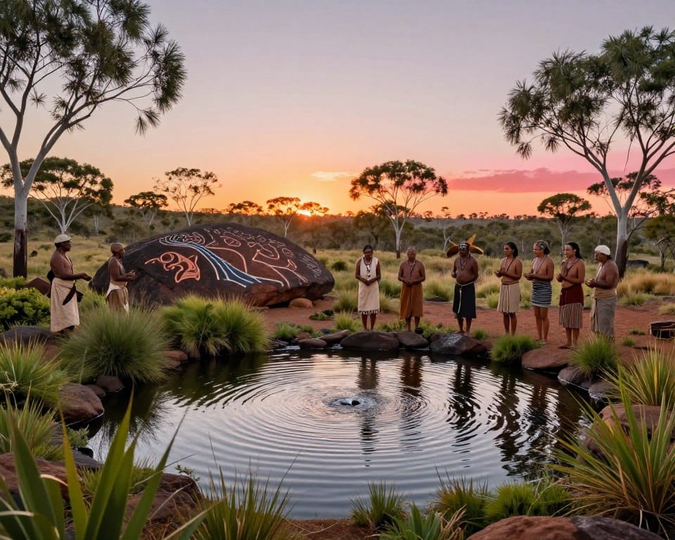
Water in indigenous Australian culture surfaces as a living thread across the continent, a presence that shapes stories, travel and care for Country.
Geospatial maps now trace about 1.3 million rivers and streams, revealing a vein-like network that moves life and knowledge across dry plains and wet coasts.
For tens of thousands of years, First Nations peoples matched craft, ceremony and stewardship to local flow patterns. Their boat designs, fishing practices and seasonal plans respond to permanent and seasonal waterways. This place-based research sits in oral stories and hands-on care, offering models for modern monitoring and sustainable management.
Key Takeaways
- First Nations view water as a living system that links ecology, law and daily practice.
- Australia’s hydrograph resembles a continent-scale circulatory network affecting mobility and food security.
- Local knowledge is built from observation, stories and tested design for craft and resource care.
- Seasonal and permanent waterways demand different stewardship and adaptive strategies.
- Field-aligned evidence and museum records support decisions in environmental monitoring.
Why water is life for First Nations peoples across Sea Country, river Country, and desert Country
Place defines practice. Saltwater, freshwater and desert peoples each encode rules, tools and calendars that match local flows and seasons.
Saltwater peoples and Sea Country
torres strait islander navigation uses the Tagai constellation to time voyages and fishing. Coastal communities read currents and migrations of dugongs and turtles.
Those observations form marine stewardship. Stories become operational rules that protect species and sustain people.

Freshwater peoples and river guardianship
Rivers, billabongs and springs are living places. The Rainbow Serpent appears in many stories as a guardian that enforces respectful behavior at waterways.
Desert peoples and songlines
Rock holes, soakages and ephemeral rivers shape travel and survival. Songlines map safe routes and record where to find life in dry seasons.
- Saltwater, freshwater and desert identities assign responsibilities to Country and sea.
- Seasonal versus permanent rivers act like continental veins; many rivers are not year-round.
- Knowledge passed across generations links ecological signals to ceremony, harvest and policy choices.
Place-based knowledge in practice: Watercraft, fisheries, and sustainable water management over thousands of years
Local makers selected hull shapes and stonework that answered waves, flow and portage needs.
Design follows Country
Tied-bark rafts and small canoes fit sheltered estuaries. Stitched-bark and dug-out craft suit open seas. Outriggers appear where long crossings and high fetch demand stability for torres strait islander mariners.
Materials and timing
Builders chose stringybark and swamp mahogany for strength. Bark was peeled when sap flowed after winter rains in new south wales to get large, flexible sheets. Lashing and resin seals improved hull longevity.
Engineering on rivers
The Brewarrina fish traps used stone weirs to stage fish movement across flow stages. This is an example of a systems-level fisheries intervention that supports food security.
- Design matches wave energy, current velocity, and portage needs.
- Generations refined lift, buoyancy and maneuverability through research and practice.
- Communities in the murray-darling basin aligned structures to seasonal discharge patterns for resilience.
| Craft/Structure | Best conditions | Key material |
|---|---|---|
| Tied-bark canoe | Sheltered estuary | Stringybark |
| Stitched-bark / Dug-out | Open coastal waters | Swamp mahogany |
| Outrigger | Long crossings, high fetch | Timber spars, lashings |
| Stone fish trap | Variable river flows | Local rock channels |
Modern teams can couple flow gauges with community knowledge to schedule maintenance, monitor sediment transport, and improve water management.
Water in Indigenous Australian culture today: rights, management, and climate pressures
Current licensing systems lock most First Nations out of formal resource management. This gap separates land title from practical access. The result is reduced cultural use and weaker community health outcomes.
Water sovereignty and policy gaps
Water sovereignty means First Nations can control flows to meet cultural obligations. Native Title covers about 32% of land. Yet First Nations hold under 1% of formal licenses. This mismatch limits community access and undermines sound management.

Law often treats water as a market good. That approach reduces environmental flows. It raises risk during climate change. Dr Virginia Marshall argues for property-style rights that embed Aboriginal knowledge in planning.
Case in point — Martuwarra Fitzroy River
The Martuwarra supports 18 endemic fish and serves as a nursery for the critically endangered Freshwater Sawfish. A 2018 sawfish die-off occurred on a pastoral property. The river faces overallocation and proposed fracking by Origin Energy, Buru Energy, and Bennet Resources.
- Include Traditional Owner councils in allocation decisions.
- Embed Indigenous indicators in environmental assessments.
- Monitor species, groundwater integrity, and flow regimes to meet community priorities and compliance.
- Report access metrics alongside flow and quality metrics to reveal inequity across basins such as the Murray-Darling Basin.
| Metric | Native Title | Licenses held |
|---|---|---|
| National land coverage | ~32% | Under 1% |
| Policy outcome | Recognized land rights | Limited practical access |
| Management need | Co-governance | Rights reform |
Reforms that link rights, access, and co-management yield measurable health gains and stronger ecological baselines. Practical steps and robust monitoring reduce conflict and improve outcomes for species and people. For related technical constraints and solutions for remote supply systems see rural supply issues.
Conclusion
Centuries of local observation have built practical systems that guide how communities manage scarce flows and resources.
Sea Country, river Country and desert Country each offer tested practices. Torres Strait Islander navigation and marine calendars sync activities to seasons. Stone fish traps and timed bark canoe builds in New South Wales are clear examples of durable engineering and applied knowledge.
Stories carry operational rules that protect life and support health across rivers and coastal waterways. Today, co-managed monitoring and Indigenous indicators create actionable pathways for fair access and stronger governance.
Professionals should apply place-based metrics and rigorous research. Use those thousands years of refinement to scale local solutions. The result is balanced policy that links peoples, places and resilient outcomes across the continent.